SCADDING COURT COMMUNITY CENTRE - Building Grounds
Parkette, middle of the pack overall (score 37, rank ~63th percentile). Strongest: connectivity; weakest: natural comfort.
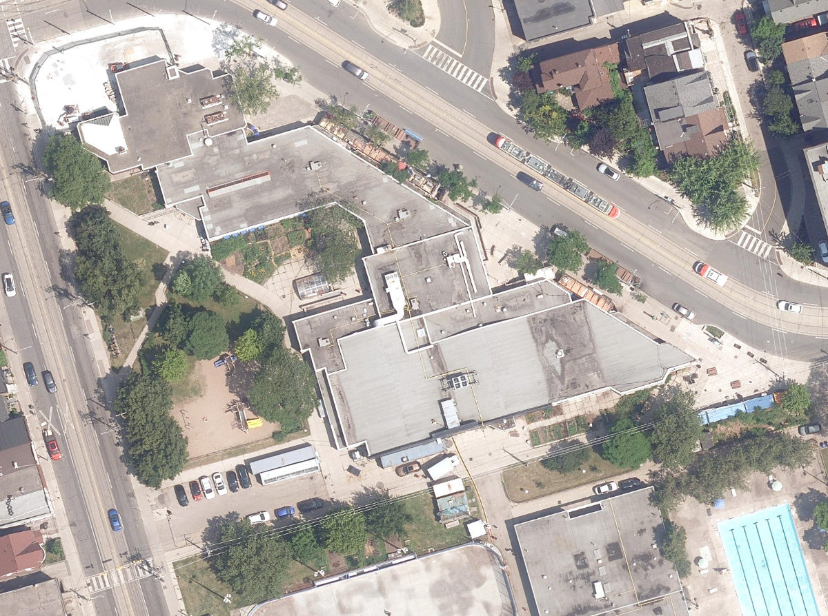
Aerial, City of Toronto orthophoto, ~8 cm/px source · cached 5/9/2026
SCADDING COURT COMMUNITY CENTRE - Building Grounds scores 36.8 / 100. Strongest dimensions: enclosure / eyes on park and connectivity. Weakest: amenity diversity (11.9). Border-vacuum risk is elevated (96). This score is a transparent reading of Jane Jacobs-style vitality factors, not a definitive judgment.
Area · 0.78 ha
Weighted across six dimensions · confidence 66%
Scores are not bell-curved. Percentiles and expected scores provide context without changing the underlying model.
Loading map…
The parks map is loading.Explain this score
Where did the 37 come from? Each weighted contribution against a neutral 50 baseline. Green = pushed up; red = pulled down.
Sum of contributions = the headline score. A negative bar means that dimension dragged the park below the city-wide neutral baseline.
Why this park works
SCADDING COURT COMMUNITY CENTRE - Building Grounds works because its connectivity score (75) is one of the city's strongest and its enclosure (77) is also top quartile (16 transit stops sit within a 400 m walk; 16 intersections fall within 100 m of the edge).
What limits this park
SCADDING COURT COMMUNITY CENTRE - Building Grounds is held back by natural comfort (38, below-average): only 0% canopy means little summer shade; border-vacuum risk is also elevated (96).
Most distinctive characteristic
Most distinctive feature: exceptionally high connectivity (75, top decile).
Jacobs reading
SCADDING COURT COMMUNITY CENTRE - Building Grounds sits between an urban social park and an ecological retreat: moderately useful for both, exceptionally suited to neither.
Tradeoffs
- Connectivity (75) significantly outpaces natural comfort (38): well placed in the city but offers little shade or ecological respite.
- The park is enclosed by buildings (77) but the surrounding streets are quiet (edge activation 23): frame without animation.
- High connectivity coexists with high border-vacuum risk (96): much of that connectivity is to highways, rail, or parking lots, not to neighbourhoods.
Typology classification
Classified as Parkette: small (7808 m²) with strong building frontage (13.5 per 100 m)
Edge Activation
Within 100 m of the park edge: 40 active uses (cafe, restaurant, community, retail, transit_stop) and 8 dead/hostile uses (parking_lot). Active edges keep "eyes on the park" through the day; parking lots, blank institutional walls, rail and highway frontages drain street life.
Source: OSM POIs (amenity/shop) + Toronto Building Footprints + land use
Connectivity
Connectivity blends paths, intersections, transit, entrances, and edge density. This park has 12 mapped paths/walkways and 30 sidewalk segments within 50 m; 16 street intersections within 100 m; 16 transit stops within a 400 m walk; 4 estimated access points across ~386 m of perimeter. edge density is healthy, no superblock penalty. Source coverage: centreline, pedestrian_network, transit_osm.
Source: Toronto Centreline V2 + Pedestrian Network + OSM transit stops
Amenity Diversity
1 distinct amenity types in the park (community_centre). Diversity, not raw count, drives the score so a park with many distinct activity types can outrank a larger park that repeats the same use.
Source: Toronto Parks & Recreation Facilities + OSM amenity tags
Natural Comfort
Natural-comfort components for this park: ~5.6% effective canopy (0.0% from contiguous tree polygons + scattered tree density); 8 city-mapped trees inside the polygon (8.0/ha). Reading: exposed. Source coverage: street_trees. Impervious surface is approximated (Toronto's authoritative layer ships only as a raster GeoTIFF).
Source: Toronto Treed Area + Ravine + Waterbodies + Street Tree Inventory
Enclosure / Eyes on Park
52 buildings within 25 m of the park edge (8 mid-rise, 44 low-rise, 0 tower); avg edge height 7.2 m (~2 floors); 13.5 buildings per 100 m of 386 m perimeter (strong frontage density); edges are low-rise (mostly 2 to 3 floors); no towers immediately adjacent. "Eyes on the park" come strongest from the 8 mid-rise edge buildings.
Source: Toronto 3D Massing (building footprints + heights)
Border Vacuum Risk
Border-vacuum factors within 50 m of the park: Impark, parking_lot, parking_lot, parking_lot, parking_lot, parking_lot, parking_lot, parking_lot. Jacobs warned that highways, rail, parking lots and blank institutional edges act as "vacuums" that suppress foot traffic and isolate the park from its neighbourhood.
Source: Toronto Street Centreline (highways) + rail layer + OSM landuse + building footprints
Equity Context
Equity Context requires inputs not yet loaded for this park (Toronto Neighbourhood Profiles). Score is held at a neutral 50 with low confidence. Read with caution.
Source: Toronto Neighbourhood Profiles
Amenities (1 types · 1 records)
- community centre
Nearby active-edge features (80)
- community: Toronto Public Library - Sanderson0 m
- community: Scadding Court Community Centre0 m
- cafe: Petit Nuage0 m
- retail: Qamar Suo0 m
- restaurant: Migustoes0 m
- retail: Dreamtech0 m
- parking lot0 m
- retail0 m
- restaurant0 m
- restaurant: Stuffed0 m
- restaurant: Original Taste2 m
- restaurant: Ethiopian2 m
- restaurant: Suzume2 m
- restaurant: Thai Street Food2 m
- restaurant: Kanto by Tita Flips2 m
- restaurant: little Banh Mi2 m
- restaurant: Nom Nom Nom Poutine2 m
- restaurant: Gushi Japanese Street Food2 m
- transit stop: Dundas Street West5 m
- parking lot8 m
- transit stop: Bathurst St at Dundas St West - Toronto Western Hospital14 m
- parking lot23 m
- parking lot23 m
- transit stop: Bathurst Street24 m
- cafe: Bailey's Cafe25 m
- restaurant: Bathurst Local26 m
- retail: Hair by Design27 m
- restaurant: McDonald's37 m
- parking lot37 m
- parking lot41 m
- transit stop: Bathurst St at Dundas St West - Toronto Western Hospital44 m
- parking lot: Impark44 m
- parking lot44 m
- transit stop: Dundas Street West47 m
- transit stop: Bathurst Street52 m
- restaurant: Buddha's Vegan Restaurant53 m
- cafe: Tim Hortons54 m
- restaurant: ami-no61 m
- retail: Trinity Drug Store66 m
- retail: Irene's Flowers70 m
- restaurant: Falafel74 m
- retail: New Fashion Shop78 m
- restaurant: Popeyes81 m
- cafe: Cha Thai83 m
- restaurant: Montauk Bar85 m
- retail: Portugal Auto Garage88 m
- cafe: Milky’s95 m
- retail: Rose Garden Flowers & Gift100 m
- restaurant: Subway101 m
- restaurant: chop chop105 m
- parking lot106 m
- retail: E Zhan Bubble Tea Internet Café107 m
- cafe: Tim Hortons109 m
- retail: Dr. Marianne Chow111 m
- retail: Paranoid113 m
- restaurant: Dundas Shawarma116 m
- retail: Sweet Hart Kitchen123 m
- restaurant: Asian Gourmet124 m
- restaurant: Gino's Pizza124 m
- restaurant: Wing Machine125 m
- transit stop: Denison Avenue131 m
- school: Downtown Vocal Music Academy of Toronto132 m
- restaurant: Edo Japan132 m
- restaurant: Greens Vegetarian Restaurant135 m
- restaurant: Carolina139 m
- restaurant: The Bagel Stop139 m
- restaurant: Druxy's Famous Deli140 m
- restaurant: Booster Juice141 m
- restaurant: Simple Burger141 m
- restaurant: Mr. Sub141 m
- restaurant: Mix it up!142 m
- restaurant: Hard Luck145 m
- retail: Paranoid Print Company148 m
- community: Paul B. Helliwell Patient & Family Library152 m
- retail: King Spic & Span Laundromat Inc.156 m
- retail: HIDE Boutique158 m
- transit stop: Denison Avenue161 m
- restaurant: Suya City162 m
- restaurant: Stelvio165 m
- retail: VdeV174 m
Park profile
Five-axis radar across the structural dimensions.
Citywide percentile ranks
Across all Toronto parks in the dataset.
- Overall vitality63th
- Edge activation79th
- Connectivity95th
- Amenity diversity78th
- Natural comfort31th
- Enclosure80th
Most similar parks
Closest in metric space across the five structural dimensions.
- Rita Cox ParkUrban Plaza45
- Osler PlaygroundParkette49
- West Birkdale ParkUrban Plaza43
- Stanley G. Grizzle ParkUrban Plaza46
- Nightstar ParkUrban Plaza46
Most opposite parks
Furthest in metric space. Useful for recognising what kind of park this isn’t.
- Trca Lands ( 26)Ravine / Naturalized Park27
- Toronto Islands - Muggs Island ParkRavine / Naturalized Park25
- Rouge ParkRavine / Naturalized Park28
- Rouge ParkRavine / Naturalized Park26
- Rouge ParkWaterfront Park25
Human activity signals: not available
No activity signals have landed for this park yet. The model has scored its physical form but it can’t yet say how often it’s programmed, photographed, or walked through. See /data-ethics for what we will and will not collect.
Does this score feel accurate?
Your read of SCADDING COURT COMMUNITY CENTRE - Building Groundsmatters. We’re testing whether the model lines up with how people actually use the park. Submissions are stored locally; no account needed.
Tell us how this park feels
We measure structure (canopy, edges, connectivity). You measure feeling. Both matter, and disagreement is itself useful civic data.
What would improve this park?
Generated from the weakest measured dimensions: a starting point, not a prescription.
- Activate the edges: encourage cafés, retail or community uses on the streets that face the park; replace blank or parking-lot edges where possible.
- Diversify what people can do in the park (playground, washroom, water, shade, performance, sport, garden): even small additions raise this score.
- Increase canopy and reduce paved area. Shade and water features extend usable hours and seasons.
- Mitigate border vacuums (highways, rail, parking) with active programming on the still-permeable edges and treat the hostile edge as a design challenge.
Data sources
- City of Toronto Open Data: Parks (Green Space)Polygon boundaries, official names, types.
- Parks & Recreation FacilitiesInventory of in-park amenities (washrooms, fields, rinks…).
- Toronto Pedestrian NetworkSidewalk segments around and through parks; estimated park entrances.
- Toronto Centreline V2Street segments + intersection nodes near park edges; trails and walkways.
- Toronto 3D MassingBuilding footprints + heights for edge-building counts, frontage density, and tower-in-the-park risk.
- Toronto Treed AreaTree canopy share inside park polygons via stratified-grid sampling.
- Toronto Waterbodies & RiversWater surface inside parks + nearest-water distance for cooling.
- Ravine & Natural Feature ProtectionRavine overlap as a cooling / natural-comfort signal.
- Toronto Street Tree InventoryTree count + density inside park polygons.
- Neighbourhood Profiles(Pending) Equity context proxy.
- OpenStreetMap (Overpass API)Cafés, restaurants, retail, transit stops, parking, highways, rail.